| Virtual Instrument | ||||||
| Mould | Foundry | StampForming | Reverse Engineer | Sheetmetal | RapidPrototyping | Thermo |
SpatialAnalyzer 2011
SpatialAnalyzer 2015

Spatial.Analyzer.v2012
Spatial.Analyzer.v2013
Spatial.Analyzer.v2014
Spatial.Analyzer.v2016
Spatial.Analyzer.v2010
Spatial.Analyzer.v2009
Spatial.Analyzer.v2008
Spatial.Analyzer.v2007
Spatial.Analyzer.v2006
Spatial.Analyzer.v2005
Spatial.Analyzer.v2004.05.23
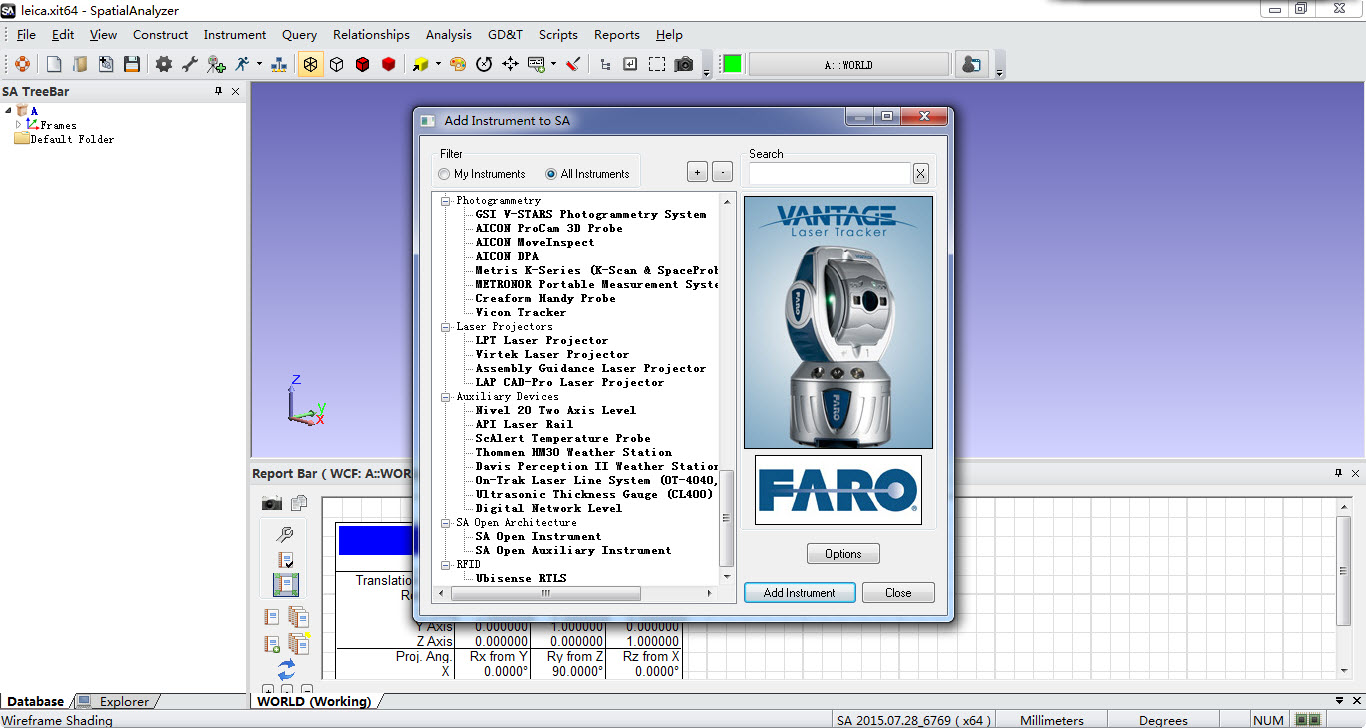
Laser Trackers
========================
FARO Vantage
FARO Ton Tracker
FARO Tracker
FARO SMX Tracker 4000,4500
FARO Chesapeake 3000 Laser Tracker
API Tracker II/III
API OmniTrace
API Tracker Device interface
API Radian
Leica AT960/930
Leica emScon AT401/402
Leica emScon Absolute Tracker
Leica emScon Tracker(LT500-800)
Leica Tracker TP-LINK
Boeing Laser Tracker
========================
Portable CMMs
========================
CimCore Arm 1028/1024/1030/2200/2500
CimCore 6DOF/7DOF
FARO Arm USB 4/6/8/10/12(7dof)
FARO Arm S08/G08/S12/G12/G08-05(7dof)/G08-12(7dof)/G04/G04-05(7dof)
API Axxis 6-100 Arm
API Axxis 6-200 Arm
API Axxis 7-100 Arm Scanner
API Axxis 7-100 Arm Probe
Hexagon Romer Multi-Gage
Hexagon Romer Absolute 7x20SI/7x25SI/7x30SI/7x35SI/7x40SI/7x45SI/7315/7x20/7x25/7x30/7x35/7x40/7x45
Metris MCA Arm
Romer Sigma Arm 2022
Sandia National Labs Arm
========================
Scanner
========================
Faro Scanner Photon/LS/Focus 3D
Boeing TaLLS Scanner
Metris Laser Radar MV200
Nikon Metrology Metris Laser Radar
Metris Laser Radar(CLRICx)
Metris CLR 100 Laser Radar
Minolta VIVID 700/900 Scanner
Metron Scanner
Creaform HandyScan 3D
NDI OptoTrak
Surphaser Scanner
Leica geosystems ScanStation P20
========================
GPS Netwoks
========================
Metris Surveyor
Metris Surveyor v2
Metris iGPS Network
Metris iGPS Transmitter Simulator
========================
Theodolites
========================
Leica/Wild Theodolites T2000/T2002
Leica TPS Theodolites(1800/5100)
Leica TM6100A Theodolites
Kern E2 Theodolites
Zeiss ETh 2 Theodolites
Cubic KIT Theodolites
========================
Total-Stations
========================
Leica TPS Total Station(2003,5000..)
Leica Total Station(TC2000,TC2002)
Sokkia Net-1 Total Station
Sokkia Net-2 Total Station
Sokkia SETX Total Station
Sokkia NET-05X Total Station
Sokkia NET-05AX Total Station
TOPCON MS AX Series Total Station
Leica TDA5005/TDRA6000 Total Station
Leica TS15/TS30 Total Station
Leica Nova MS50 Total Station
Leica T1200 Total Station
========================
Photogrammetyc
========================
GSI V-STARS Photogrammety System
AICON ProCam 3D Probe
AICON NoveInspect
AICON DPA
Metris E-Series(K-Scan & SpaceProbe)
Metronor Portable Measurement System
Creaform Handy Probe
Vicon Tracker
========================
Laser Projectors
========================
LPT Laser projector
Virtek Laser projector
Assembly Guidance Laser projector
LAP CAD-Pro Laser projector
========================
Auxiliary Devices
========================
Nivel 20 Two Axis Level
API Laser Rail
ScAlert Temperature Probe
Thommen HM30 Weather Station
Davis Perception II Weather Station
On-Trak Laser Line System(OT-4040,)
Ultrasonic Thickness Gauge(CL400)
Digital Network Level
========================
RFID
========================
Ubisense RTLS
spatial analyzer download
spatial analyzer user manual
spatial analyzer training
spatial analyzer support
spatial analyzer system requirements
hexagon spatial analyzer
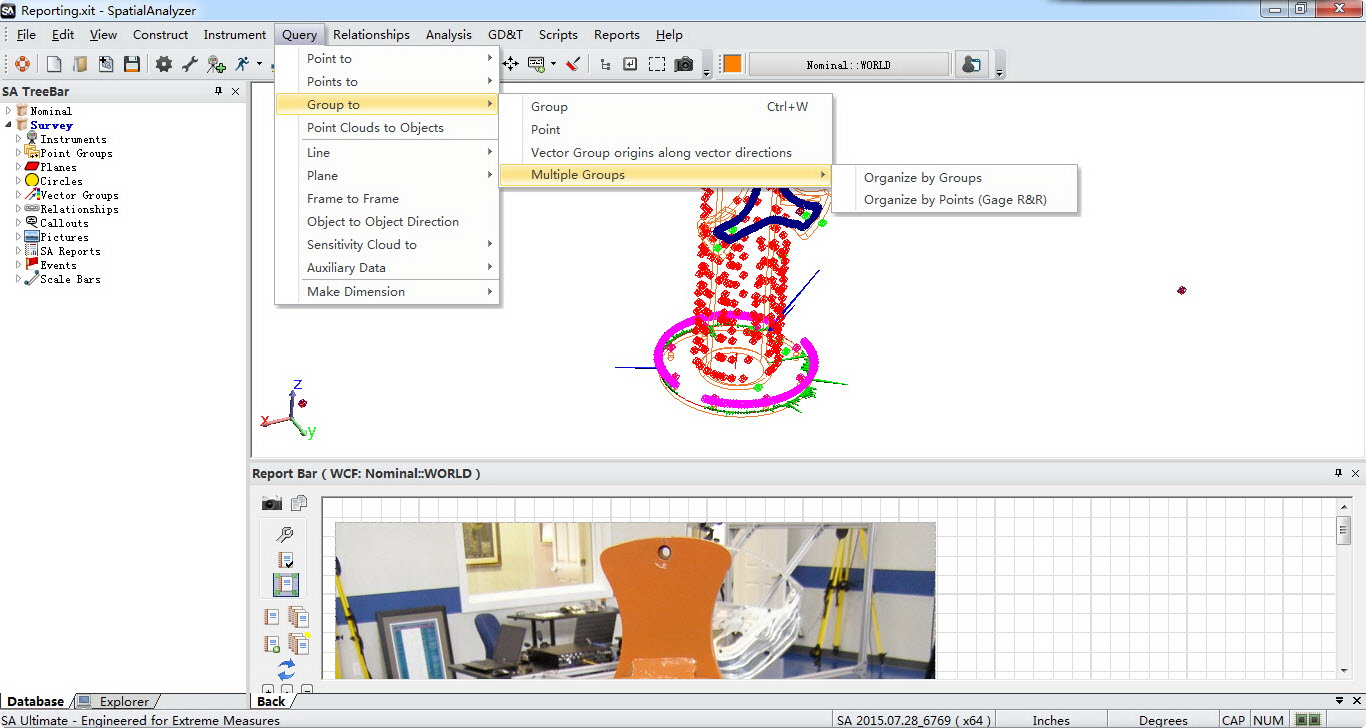
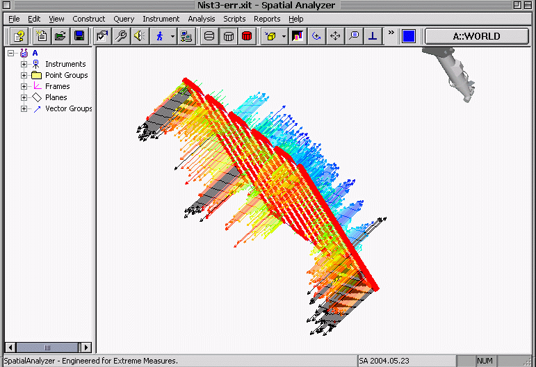
SpatialAnalyzer is the premier portable metrology software solution for large-scale applications. SA is an instrument-independent, traceable 3D graphical software platform that makes it easy for users to integrate data from multiple instruments and perform complex tasks simply, ultimately improving productivity.
SA is a highly flexible, instrument-independent, traceable 3D graphical software platform that makes it easy for users to:
Inspect parts
Build
Analyze data
Report
Reverse design
Interface with virtually any type of portable metrology instrument
Automate complex operations to improve measurement and inspection efficiencies.
Instrument-independent, SA can simultaneously communicate with virtually any number and type of portable metrology instruments while performing complex tasks simply. SA can also integrate data from multiple instruments and help users find the best optimization to improve accuracy, save time, and reduce scrap. Interfacing with 120+ instruments (Laser Trackers, Local GPS, Portable CMM's, Theodolites, Total Stations, Laser Scanners, etc), SA provides simple, common interfaces for each instrument class.
Spatial Analyzer Benutzerhandbuch
Spatial Analyzer Schulung
Spatial Analyzer Unterstützung
Spatial Analyzer Systemanforderungen
hexagon räumlicher analysator
SpatialAnalyzer ist die erste tragbare Messsoftwarelösung für groß angelegte Anwendungen. SA ist eine geräteunabhängige, rückverfolgbare grafische 3D-Softwareplattform, die es dem Benutzer erleichtert, Daten von mehreren Geräten zu integrieren und komplexe Aufgaben einfach auszuführen, was letztlich die Produktivität erhöht.
SA ist eine hochflexible, geräteunabhängige, rückverfolgbare grafische 3D-Softwareplattform, die es den Anwendern leicht macht,:
Prüfen von Teilen
Erstellen von
Analysieren von Daten
Berichte erstellen
Konstruktion rückgängig machen
Schnittstelle zu praktisch allen Arten von tragbaren Messinstrumenten
Automatisieren Sie komplexe Vorgänge, um die Effizienz von Messungen und Prüfungen zu verbessern.
SA ist geräteunabhängig und kann gleichzeitig mit praktisch jeder Anzahl und jedem Typ von tragbaren Messgeräten kommunizieren und dabei komplexe Aufgaben einfach ausführen. SA kann auch Daten von mehreren Messgeräten integrieren und dem Benutzer helfen, die beste Optimierung zu finden, um die Genauigkeit zu verbessern, Zeit zu sparen und Ausschuss zu reduzieren. SA kann mit über 120 Instrumenten (Laser Tracker, lokales GPS, tragbare KMGs, Theodoliten, Totalstationen, Laserscanner usw.) kommunizieren und bietet einfache, gemeinsame Schnittstellen für jede Instrumentenklasse.
manual do utilizador do analisador espacial
formação em analisadores espaciais
apoio ao analisador espacial
requisitos do sistema analisador espacial
analisador espacial hexagonal
O SpatialAnalyzer é a principal solução de software portátil de metrologia para aplicações em larga escala. SA é uma plataforma de software gráfico 3D independente de instrumentos e rastreável que facilita aos utilizadores a integração de dados de múltiplos instrumentos e a execução de tarefas complexas de forma simples, melhorando, em última análise, a produtividade.
SA é uma plataforma de software gráfico 3D altamente flexível, independente de instrumentos e rastreável, que facilita aos utilizadores a integração de dados de múltiplos instrumentos e a execução de tarefas complexas, melhorando, em última análise, a produtividade:
Inspeccionar peças
Construir
Analisar dados
Relatório
Desenho invertido
Interface com praticamente qualquer tipo de instrumento portátil de metrologia
Automatizar operações complexas para melhorar a eficiência das medições e inspecções.
A SA, independente de instrumentos, pode simultaneamente comunicar com praticamente qualquer número e tipo de instrumentos de metrologia portáteis enquanto executa tarefas complexas de forma simples. A SA pode também integrar dados de múltiplos instrumentos e ajudar os utilizadores a encontrar a melhor optimização para melhorar a precisão, poupar tempo, e reduzir sucata. Interfaces com mais de 120 instrumentos (Laser Trackers, GPS local, CMM's portáteis, Teodolitos, Estações totais, Scanners laser, etc.), SA fornece interfaces simples e comuns para cada classe de instrumentos.
uzamsal anali̇zör kullanim kilavuzu
mekansal anali̇zör eği̇ti̇mi̇
uzamsal analizör desteği
uzamsal anali̇zör si̇stem gereksi̇ni̇mleri̇
hexagon uzamsal anali̇zör
SpatialAnalyzer, büyük ölçekli uygulamalar için önde gelen taşınabilir metroloji yazılımı çözümüdür. SA, kullanıcıların birden fazla cihazdan gelen verileri entegre etmesini ve karmaşık görevleri basit bir şekilde gerçekleştirmesini kolaylaştıran ve sonuçta verimliliği artıran, cihazdan bağımsız, izlenebilir bir 3B grafik yazılım platformudur.
SA, kullanıcıların aşağıdakileri yapmasını kolaylaştıran son derece esnek, cihazdan bağımsız, izlenebilir bir 3D grafik yazılım platformudur:
Parçaları incelemek
İnşa etmek
Veri analizi
Rapor
Ters tasarım
Neredeyse her tür taşınabilir metroloji cihazı ile arayüz
Ölçüm ve denetim verimliliğini artırmak için karmaşık işlemleri otomatikleştirin.
Cihazdan bağımsız olan SA, karmaşık görevleri basitçe yerine getirirken neredeyse her sayıda ve türde taşınabilir metroloji cihazıyla eşzamanlı olarak iletişim kurabilir. SA ayrıca birden fazla cihazdan gelen verileri entegre edebilir ve kullanıcıların doğruluğu artırmak, zamandan tasarruf etmek ve hurdayı azaltmak için en iyi optimizasyonu bulmalarına yardımcı olabilir. 120'den fazla cihazla (Lazer Takip Cihazları, Yerel GPS, Taşınabilir CMM'ler, Teodolitler, Total Station'lar, Lazer Tarayıcılar, vb) arayüz oluşturan SA, her cihaz sınıfı için basit, ortak arayüzler sağlar.
manual de usuario del analizador espacial
formación de spatial analyzer
soporte de spatial analyzer
requisitos del sistema spatial analyzer
hexagon spatial analyzer
SpatialAnalyzer es la principal solución de software de metrología portátil para aplicaciones a gran escala. SA es una plataforma de software gráfica 3D independiente de los instrumentos y trazable que facilita a los usuarios la integración de los datos procedentes de varios instrumentos y la realización de tareas complejas de forma sencilla, mejorando en última instancia la productividad.
SA es una plataforma de software gráfico 3D altamente flexible, independiente de los instrumentos y trazable, que facilita a los usuarios:
Inspeccionar piezas
Construir
Analizar datos
Elaborar informes
Invertir el diseño
Interfaz con prácticamente cualquier tipo de instrumento de metrología portátil
Automatice las operaciones complejas para mejorar la eficiencia de las mediciones e inspecciones.
Independiente de los instrumentos, SA puede comunicarse simultáneamente con prácticamente cualquier número y tipo de instrumentos de metrología portátiles y realizar tareas complejas de forma sencilla. SA también puede integrar los datos de varios instrumentos y ayudar a los usuarios a encontrar la mejor optimización para mejorar la precisión, ahorrar tiempo y reducir los desechos. Con una interfaz para más de 120 instrumentos (rastreadores láser, GPS locales, MMC portátiles, teodolitos, estaciones totales, escáneres láser, etc.), SA proporciona interfaces sencillas y comunes para cada clase de instrumento.
manuale d'uso dell'analizzatore spaziale
formazione sull'analizzatore spaziale
supporto per l'analizzatore spaziale
requisiti di sistema dell'analizzatore spaziale
analizzatore spaziale hexagon
SpatialAnalyzer è la principale soluzione software di metrologia portatile per applicazioni su larga scala. SA è una piattaforma software grafica 3D tracciabile e indipendente dagli strumenti che consente agli utenti di integrare facilmente i dati provenienti da più strumenti e di eseguire operazioni complesse in modo semplice, migliorando la produttività.
SA è una piattaforma software grafica 3D altamente flessibile, indipendente dagli strumenti e tracciabile, che consente agli utenti di:
Ispezionare parti
Costruire
Analizzare i dati
Fare report
Invertire la progettazione
Interfacciamento con qualsiasi tipo di strumento metrologico portatile
Automatizzare operazioni complesse per migliorare l'efficienza delle misure e delle ispezioni.
Indipendente dagli strumenti, SA è in grado di comunicare simultaneamente con qualsiasi numero e tipo di strumenti metrologici portatili e di eseguire operazioni complesse in modo semplice. SA può anche integrare i dati provenienti da più strumenti e aiutare gli utenti a trovare la migliore ottimizzazione per migliorare la precisione, risparmiare tempo e ridurre gli scarti. Interfacciandosi con oltre 120 strumenti (Laser Tracker, GPS locali, CMM portatili, teodoliti, stazioni totali, laser scanner, ecc.), SA fornisce interfacce semplici e comuni per ogni classe di strumenti.